


The Gila Natonal Forest is massive: 3.3 million acres and includes 568,000 acres of what was the first designated "wilderness" in the country, back in 1924. Gila still hosts more wilderness than in any other national forest in the Southwest. We saw cactus, juniper, pine, spruce, aspen and, of course, the Gila River that meanders throughout the Park. 


It was a gorgeous day; sunny, in the mid-70's. We took the scenic "Mountain Spirits" byway that loops to and from the Cliff Dwellings Monument and starts in Silver City where we were staying.


There are 12 mountain ranges in the Gila National Forest. This one is the Mogollon Range, named for the people who lived in the Dwellings that are now the National Monument. The elevations in the Gila National Forest start at 4,500 ft in the Chihuahuan Desert and rise to almost 11,000 feet on the Whitewater Baldy Crest. It is extreme terrain that enhances the beauty of the area.


See the deer standing beside the road in the photo above - looking back at us taking picutes of him.


The photo above is the Gila River, which flows throughout the year due to underground springs and snowmelt from the various mountain ranges.


The area is also blessed with various hot springs. Hikers are able to visit these springs and enjoy dipping in them, but you have to be willing to get your feet wet en route as these trails cross the River in multiple places. We decided that the cold winter temps of the River were a deterrent to us making this trec on this trip....perhaps we can return in the summer to get our feet wet!


Notice the Mexican Grey Wolf in the foreground of this photo taken in the Visitor's Center at the base of the trail that leads to the Cliff Dwellings. This once endangered animal now thrives in the Gila Forest. The hike we took later in the afternoon had some information about the animal that lives in that part of the Forest. We did not see any, other than the guy in the case above.


 We are now en route up the one-mile trail that takes you to the Cliff Dwellings National Monument. It crosses the River a few times on bridges like the one Oliver is at in the photo above and rises 180 feet from its starting point. As we walked up to see the monument, we marveled at how difficult this must have been to hike this terrain to farm, hunt and retrieve water from the river.


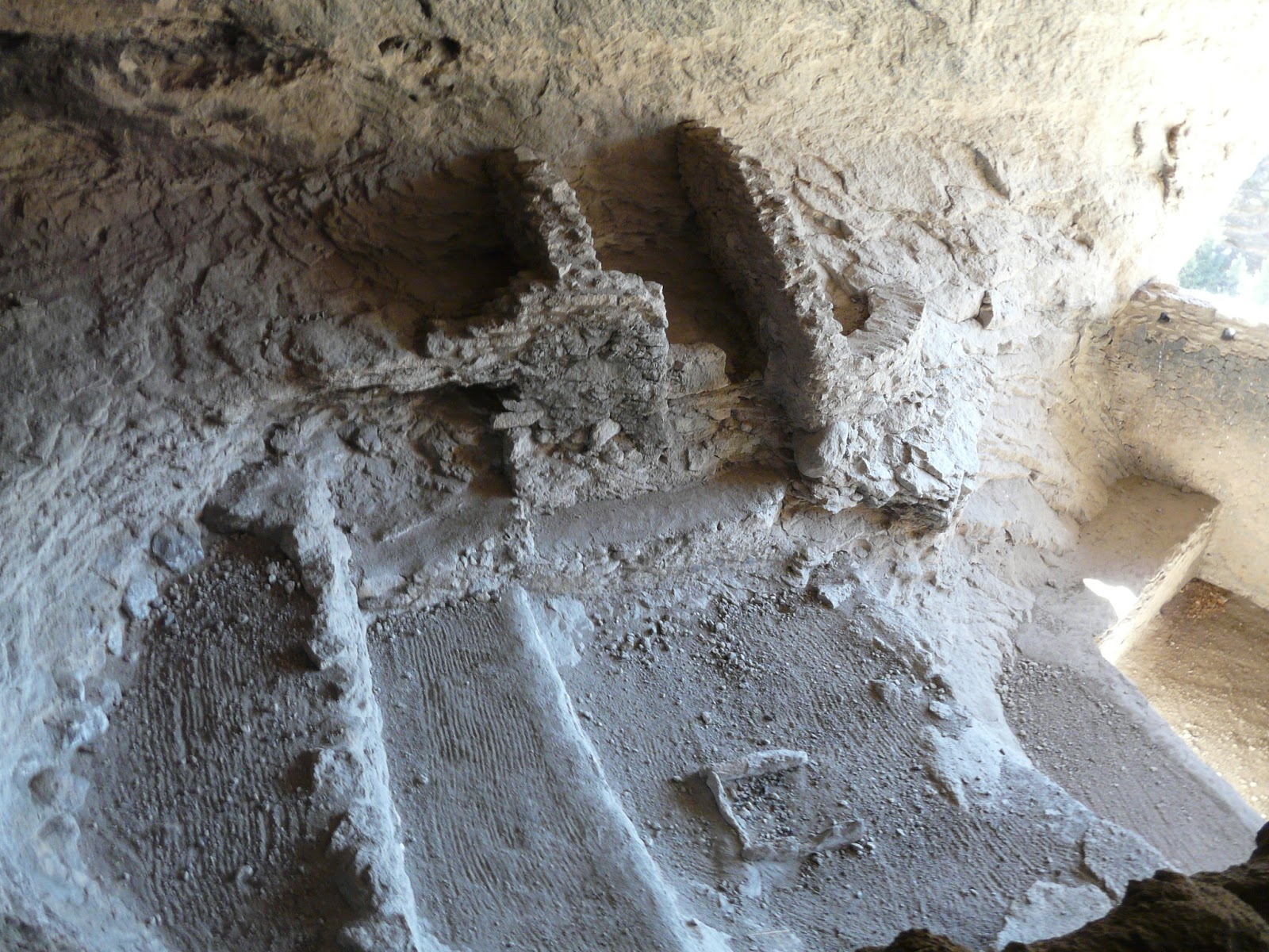
The people who built these Dwellings were part of the Mogollon culture (mo-go-yon). They combined hunting and gathering with farming and enjoyed the fertile soil of the Gila Valley for their crops of beans, corn and squash. They think these people lived here from approx. 1276 to 1287 and abandoned their homes around 1300. They are not certain why they left, but one theory suggests that an extreme drought might have forced them to leave.


Oliver crosses the final bridge at the Monument in the photo below.


The remaning photos were taken during our hike in the Lake Roberts section of the park. The trail lead us up and down, through a canyon, and back up along a ridgeline. We really enjoyed the peacefulness of our hike and did not see one single person! There are so many hiking trails in this remote Forest, it is not difficult to find space and quietness for yourself.


No comments:
Post a Comment